
Ordnance Survey Landranger Map 49 – Oban & East Mull Topographic mapping Highly detailed contour mapping highlighting variations in terrain and everything you would expect from a map Explore local landmarks Discover camping sites, picnic spots, tourist information, car parks, historical sites, pubs, & much more Free digital map download Every 4cm on the map is 1km, making our leisure selection the most detailed maps; perfect for activities such as walking, running, and cycling Be ready for anything Find marked public rights of way, byways, trails, cycle routes, bridleways, road networks, & railway lines

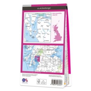 Ordnance Survey Landranger Map 63 Firth of Clyde Navigation & Maps
£14.99
Ordnance Survey Landranger Map 63 Firth of Clyde Navigation & Maps
£14.99
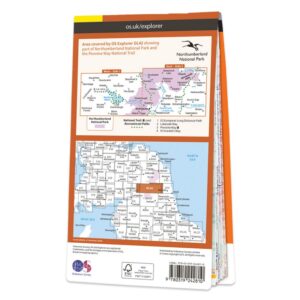 Ordnance Survey Map OL 42 Kielder Water & Forest Navigation & Maps
£14.99
Ordnance Survey Map OL 42 Kielder Water & Forest Navigation & Maps
£14.99
Ordnance Survey Landranger Map 49 – Oban & East Mull Navigation & Maps
£14.99
The Ordnance Survey Landranger Map 49 offers a dependable solution for camping and shelter use, combining durability with user-friendly design. It’s built to handle demanding conditions while remaining easy to carry and use. A great addition to any camping or adventure setup.


Reviews
There are no reviews yet.